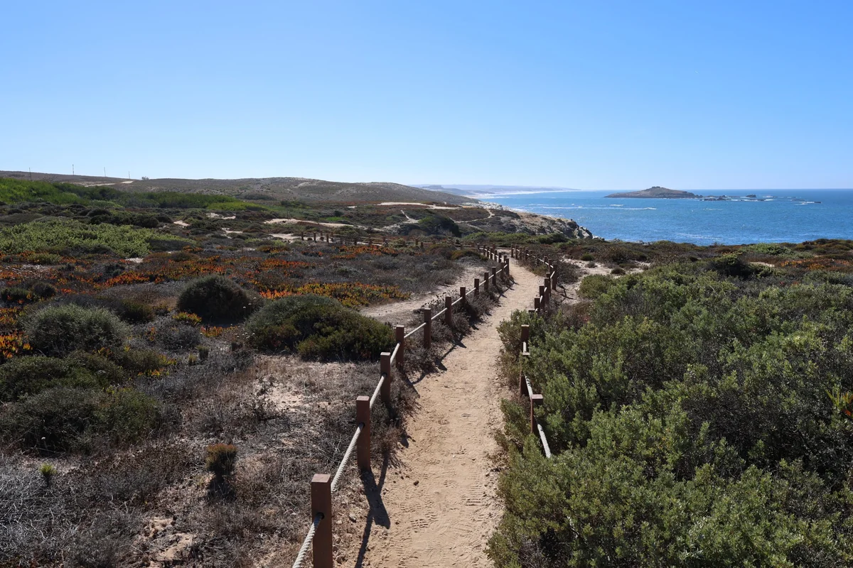
A sandy path between rope fences crossing coastal scrub, with the Atlantic and a small rocky island on the horizon
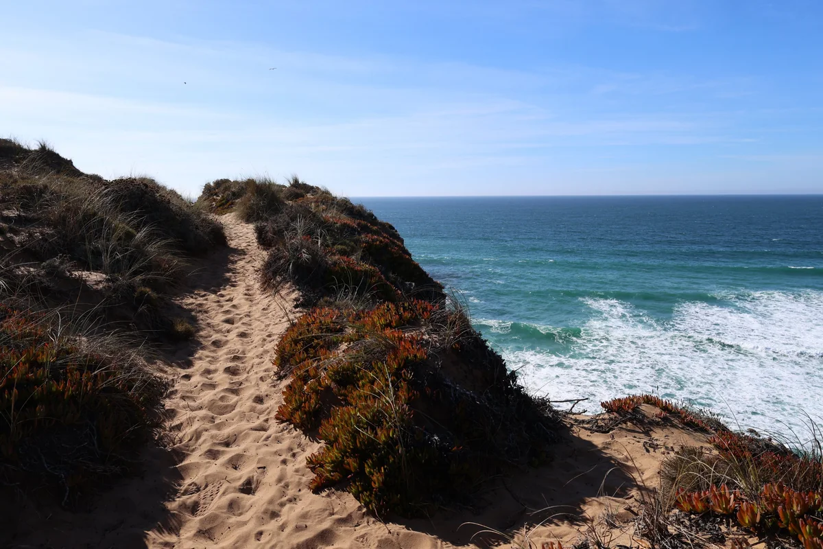
A deep sandy footpath along the top of a cliff, with ice plants on the edge and waves breaking below
Portugal Alentejo coast (Rota Vicentina) Verified campsite to campsite, checked November 2026

Fishermen's Trail: Porto Covo to Odeceixe in 4 days

Clifftop paths and sandy fishermen's tracks along Europe's wildest Atlantic coast, from Porto Covo to Odeceixe, in four days with a campsite every night, a short beach day and one 15-minute taxi ride.

Download GPX
Total distance
66.9 km
Walking days
4
Avg per day
16.7 km
Ascent / descent
+1,200 / −1,190 m
Difficulty
Moderate
Best period
Mar – Sep
Route type
Point to point
Solid line: planned track along OpenStreetMap paths. Dashed: no track yet. Map: OpenFreeMap / OpenStreetMap.

Elevation profile

-100 0 100 200 0 km10 km20 km30 km40 km50 km60 km Day 1 Day 2 Day 3 Day 4
From 2 m to 89 m over 66.9 km. Elevation in metres, from the planned track.

Photos from the trail

1 / 1
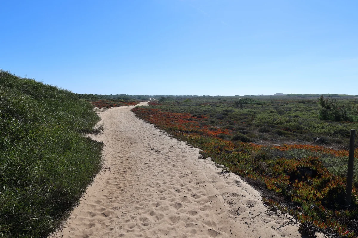
A wide track of soft sand through dune scrub and red ice plants under a clear blue sky
Long stretches of soft sand make the flat days slower than the distance suggests

When to go

The top row shows when the trail itself is in good condition (snow, heat, services). Below it, when each campsite is open — the trek works when both line up. Trail conditions can differ from year to year, so always keep an eye on local websites before and during your trek.

When the trail is in condition, opening months per campsite, and when all campsites are open together
Row AprMayJunJulAugSepOct
Trail season BestBestPossiblePossiblePossibleBestNot advised
Campsites open
Vila Nova de Milfontes OpenOpenOpenOpenOpenOpenOpen
Zambujeira do Mar OpenOpenOpenOpenOpenOpenOpen
Praia do Carvalhal (São Teotónio) OpenOpenOpenOpenOpenOpenOpen
Odeceixe OpenOpenOpenOpenOpenPartClosed
All campsites open OpenOpenOpenOpenOpenPartClosed

Day by day

Day 1: Porto Covo → Vila Nova de Milfontes

Distance
20.3 km
Up / down
+250 / −250 m
Walking time
5h 45

Landscape

Beaches, dunes and low cliffs from Porto Covo south to the Mira estuary.

Along the way

Ilha do Pessegueiro with its ruined fort; long empty beaches.

Water & groceries

Shops in Porto Covo; almost nothing on the way. Carry 2–3 litres of water.

Tonight

Camping Milfontes. Campsite in town; shops and restaurants nearby.

Day 2: Vila Nova de Milfontes → Zambujeira do Mar

Distance
23.3 km
Up / down
+400 / −370 m
Walking time
6h 45

Transfer to the start (taxi, 15 min): walk 0 min from the campsite to Vila Nova de Milfontes, ride to Almograve. Book in advance (Uber/Bolt also work in the area). Skips the 16 km stretch Milfontes – Almograve (Mira crossing, Furnas beach, Almograve cliffs).

Landscape

After a short taxi ride to Almograve, the wildest stretch: dunes, cliffs, the lighthouse at Cabo Sardão and the fishing harbour of Entrada da Barca.

Along the way

Cabo Sardão lighthouse and white storks nesting on the sea cliffs; Entrada da Barca harbour.

Water & groceries

Very little on the way — the village of Cavaleiro near Cabo Sardão is the only place to look for a café. Carry water for the whole day.

Tonight

Camping Villa Park Zambujeira. Campsite at the entrance to Zambujeira do Mar, about 1 km inland from the cliffs; mini-market and restaurant on site.

Day 3: Zambujeira do Mar → Praia do Carvalhal (São Teotónio)

Distance
6.2 km
Up / down
+130 / −130 m
Walking time
2h

Landscape

A short morning along the cliffs from Zambujeira to Carvalhal beach — time to swim and rest.

Along the way

Carvalhal beach and Machados beach, both a few minutes from the campsite.

Water & groceries

Shops in Zambujeira do Mar; mini market at the campsite.

Tonight

Parque de Campismo Monte Carvalhal da Rocha. Large terraced campsite 600 m from the trail, near Carvalhal beach. Open all year.

Day 4: Praia do Carvalhal (São Teotónio) → Odeceixe

Distance
17.1 km
Up / down
+420 / −440 m
Walking time
5h 30

Landscape

Clifftop paths and small coves south to the Seixe river.

Along the way

Azenha do Mar fishing harbour; the river mouth and beach at Odeceixe.

Water & groceries

Shops in Odeceixe.

Tonight

Parque de Campismo São Miguel. Campsite in the pine forest near São Miguel, about 1.8 km off the trail (included in today's distance). Arrive before 20:00 — the gate closes then.

Walking times are calculated with the DIN 33466 hiking formula (4 km/h, 300 m/h up, 500 m/h down), without breaks.

About this trek

The Fishermen’s Trail (Trilho dos Pescadores) is the coastal route of the Rota Vicentina. It follows the paths that local fishermen use to reach the beaches and rocky fishing spots along the Alentejo coast, one of the wildest and best-protected coastlines in Europe. Expect red cliffs, hidden coves, storks nesting on sea stacks and long sections of soft sand.

This is the original Porto Covo – Odeceixe section of the trail (the official trail now starts 10 km further north at São Torpes and continues to Lagos). Wild camping is forbidden, and there is no campsite between Vila Nova de Milfontes and Zambujeira do Mar.

One taxi ride. On the morning of day 2 you take a taxi from Vila Nova de Milfontes to Almograve (about 15 minutes) and start walking from there. This skips one 16 km stretch of the trail (the Mira crossing, Furnas beach and the cliffs at Almograve) but keeps the best part: Cabo Sardão and its stork cliffs. Book the taxi the day before; Uber and Bolt also work here. Every other kilometre you walk from campsite to campsite.

Why camp to camp here? It is a classic, and it works well in spring and autumn when the Alps are still under snow or already closed. It is not a mountain trek: climbs are short, but walking on sand is slow with a full pack.

Campsite to Campsite check

Automatic check of our eight conditions.

  • Every night at a regular campsite that accepts tents
  • Every campsite reachable on foot from the route
  • Each stage starts where yesterday ended — at most a short transfer of 30 minutes, always shown
  • No wild camping or bivouacs needed
  • No huts, hotels or hostels as standard overnight
  • All campsites open during the stated season
  • Daily distance and ascent measured and checked
  • Walkable with a full trekking pack

GPX downloads

Works with Garmin, Komoot, OsmAnd and other apps.

Walked it recently?

Report a closed campsite, a detour or a new water point. Every report is checked before the route changes.

Report an update

Fishermen's Trail: Porto Covo to Odeceixe in 4 days