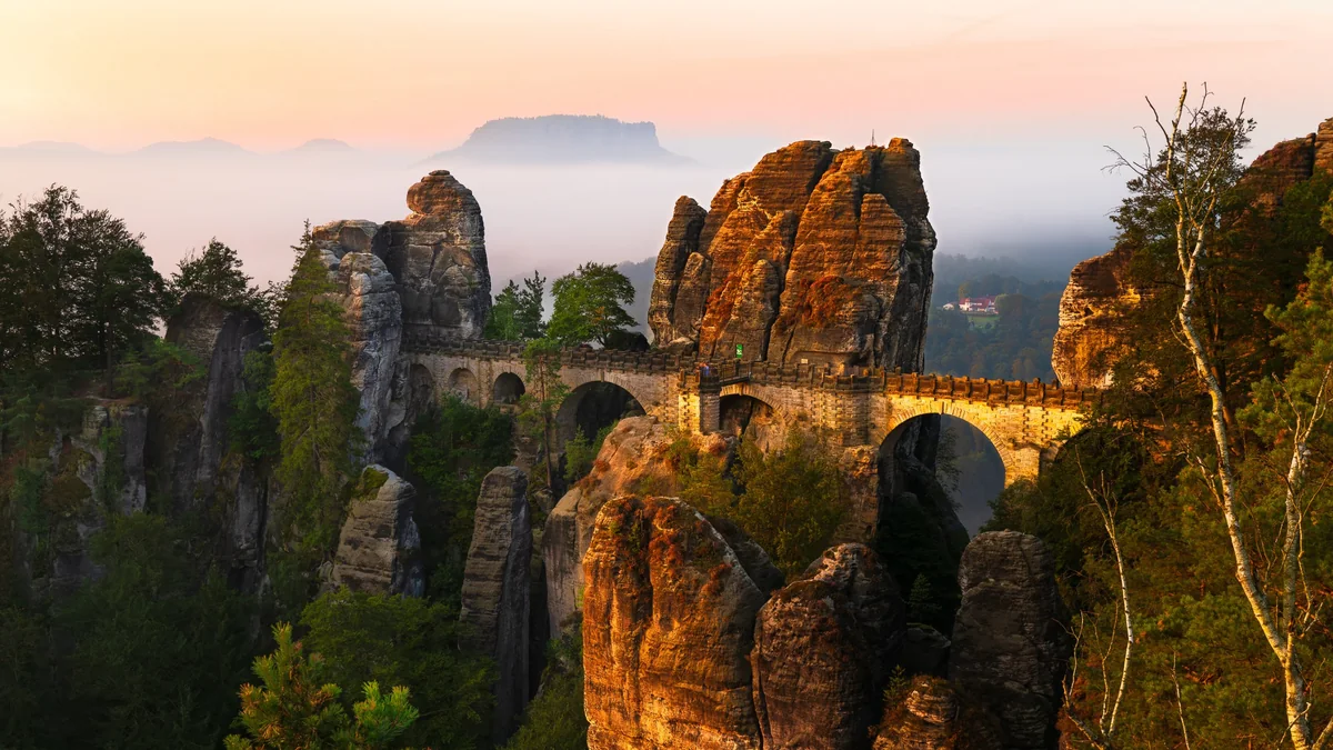
The stone arches of the Bastei bridge between sandstone towers at sunrise, with the Lilienstein table mountain rising above the morning mist
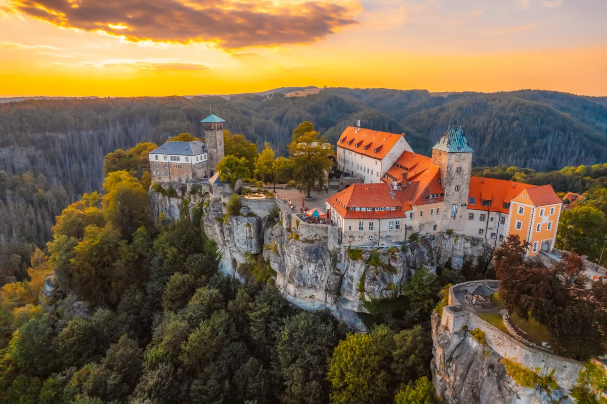
Hohnstein castle on its sandstone cliff above the forest at sunset
Germany Saxon Switzerland Verified campsite to campsite, checked November 2026

Malerweg in 7 days

The Painters' Way through Saxon Switzerland: sandstone towers, steep stairways and Elbe views, with a regular campsite every night and one short train ride after Schmilka.

Download GPX
Total distance
104.4 km
Walking days
7
Avg per day
14.9 km
Ascent / descent
+3,310 / −3,360 m
Difficulty
Challenging
Best period
Apr – Oct
Route type
Loop
Solid line: planned track along OpenStreetMap paths. Dashed: no track yet. Map: OpenFreeMap / OpenStreetMap.

Elevation profile

0 200 400 600 0 km10 km20 km30 km40 km50 km60 km70 km80 km90 km100 km Day 1 Day 2 Day 3 Day 4 Day 5 Day 6 Day 7
From 113 m to 540 m over 104.4 km. Elevation in metres, from the planned track.

Photos from the trail

1 / 1
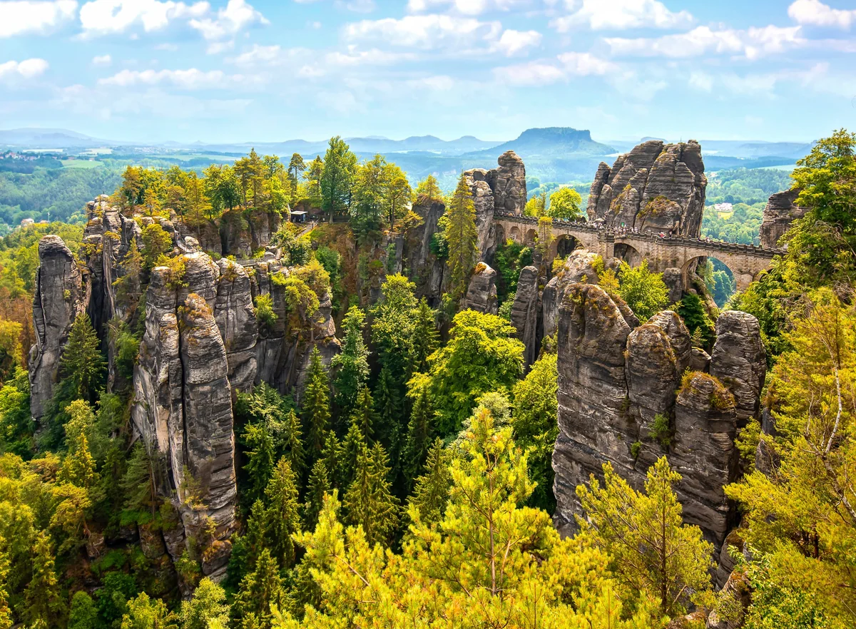
The Bastei rock towers and bridge from above, with forested valleys and the Lilienstein on the horizon

When to go

The top row shows when the trail itself is in good condition (snow, heat, services). Below it, when each campsite is open — the trek works when both line up. Trail conditions can differ from year to year, so always keep an eye on local websites before and during your trek.

When the trail is in condition, opening months per campsite, and when all campsites are open together
Row AprMayJunJulAugSepOct
Trail season Not advisedBestBestPossiblePossibleBestPossible
Campsites open
Stadt Wehlen PartOpenOpenOpenOpenOpenPart
Hohnstein OpenOpenOpenOpenOpenOpenOpen
Kirnitzschtal (Bad Schandau) OpenOpenOpenOpenOpenOpenOpen
Hinterhermsdorf OpenOpenOpenOpenOpenOpenOpen
Königstein OpenOpenOpenOpenOpenOpenOpen
Struppen OpenOpenOpenOpenOpenOpenOpen
Pirna OpenOpenOpenOpenOpenOpenOpen
All campsites open PartOpenOpenOpenOpenOpenPart

Day by day

Day 1: Pirna / Liebethal → Stadt Wehlen

Distance
12.5 km
Up / down
+210 / −240 m
Walking time
3h 45

Landscape

From Liebethal through the Liebethaler Grund gorge, past Lohmen and down the Uttewalder Grund to the Elbe.

Along the way

The Liebethaler Grund gorge with the Wagner monument; the Uttewalder Felsentor rock gate.

Water & groceries

Shops in Pirna before you start; small shops in Stadt Wehlen.

Tonight

Zeltplatz Verein Kanusport Dresden (DKV-Kanustation). Tent field of the Dresden canoe club on the Elbe, about 800 m past the town towards the Bastei (included in today's distance). Tents only, cooking area and shower; request a place in advance.

Day 2: Stadt Wehlen → Hohnstein

Distance
18.3 km
Up / down
+690 / −490 m
Walking time
6h 15

Landscape

Through the Rathen rocks and the Schwedenlöcher gorge, over the Bastei and on to Hohnstein.

Along the way

The Bastei bridge — the most famous view in Saxon Switzerland; Amselsee; Hohnstein castle.

Water & groceries

Kiosks and restaurants at the Bastei and in Rathen. Buy food in Hohnstein before the road walk to the campsite.

Tonight

Camping Entenfarm. The campsite is about 1.6 km off the trail beyond Hohnstein (included in today's distance).

Day 3: Hohnstein → Kirnitzschtal (Bad Schandau)

Distance
14.3 km
Up / down
+390 / −580 m
Walking time
4h 45

Landscape

Back to Hohnstein, past the Brand viewpoint and down through forest to the Kirnitzsch valley.

Along the way

The Brand-Baude viewpoint over the table mountains; the Polenz valley.

Water & groceries

Inn at the Brand (opening days to verify). Shops in Bad Schandau by tram only.

Tonight

Campingplatz Ostrauer Mühle. Directly on the trail by the Kirnitzsch; no mobile reception.

Day 4: Kirnitzschtal (Bad Schandau) → Hinterhermsdorf

Distance
22.7 km
Up / down
+870 / −650 m
Walking time
7h 45

Landscape

Up through the Kirnitzsch side valleys and the deep forest of the rear Saxon Switzerland, past the Neumannmühle and on up through the forest to Hinterhermsdorf.

Along the way

Lichtenhainer Wasserfall; the Kuhstall rock arch and the Himmelsleiter ladder.

Water & groceries

Inns at the Lichtenhainer Wasserfall and the Kuhstall (opening days to verify). Carry water.

Tonight

Camping Thorwaldblick. A long day. Shorter option: stop at the Neumannmühle (after about 15.7 km) and take bus 241 up to Hinterhermsdorf (about 10 min, last bus around 18:00). You then miss about 5 km of the Malerweg, which you do not walk again on day 5.

Day 5: Hinterhermsdorf → Königstein

Distance
10.8 km
Up / down
+470 / −710 m
Walking time
4h 15

Landscape

Back through the forest the way you came for about 2 km, then on along the Malerweg below the Kleines Pohlshorn. Then over the Großer Winterberg and down through the forest to Schmilka on the Elbe.

Along the way

Großer Winterberg; the Kipphorn viewpoint; the old mill in Schmilka.

Water & groceries

Inn on the Großer Winterberg (opening days to verify); bakery and brewery in Schmilka.

Tonight

Camping Königstein. No campsite in Schmilka: take the ferry across the Elbe and the S-Bahn to Königstein (about 15 min) and sleep at Camping Königstein.

Day 6: Königstein → Struppen

Distance
17 km
Up / down
+600 / −470 m
Walking time
5h 45

Landscape

Out of Königstein below the fortress and over the plateau to Weißig, then past the Rauenstein to Struppen.

Along the way

Views of Königstein fortress and the Lilienstein; the Rauenstein ridge.

Water & groceries

Shops in Königstein at the start. No shop in Weißig; bakery in Struppen (opening days to verify).

Tonight

Camping-Stellplatz Struppen. Small campsite at the edge of Struppen with a wide view of the table mountains, about 500 m off the trail (included).

Day 7: Struppen → Pirna

Distance
8.8 km
Up / down
+80 / −220 m
Walking time
2h 30

Landscape

Across the open plateau with views back to the table mountains, then down to the Elbe and into Pirna.

Along the way

The Königsnase viewpoint; Pirna's old town at the finish.

Water & groceries

Shops in Pirna — closed on Sundays.

Tonight

Camping Wasserplatz Pirna. Small campsite on the Elbe near the old town and the station — or take the S-Bahn home.

Walking times are calculated with the DIN 33466 hiking formula (4 km/h, 300 m/h up, 500 m/h down), without breaks.

About this trek

The Malerweg — the Painters’ Way — is one of Germany’s most popular long-distance trails. It loops through Saxon Switzerland, a landscape of sandstone towers, deep gorges and table mountains above the Elbe that inspired the Romantic painters. The path is never flat: expect stairways cut into the rock, iron ladders and steep climbs to one viewpoint after another.

Camping is the hard part. Wild camping is not allowed in the national park, and two official stage ends — the Neumannmühle and Schmilka — have no campsite nearby. This version solves that by walking on from the Neumannmühle to the campsite in Hinterhermsdorf: day 4 becomes a long day of about 23 km. You can shorten it with bus 241 from the Neumannmühle up to Hinterhermsdorf (about 10 minutes), but then you miss about 5 km of the Malerweg. On day 5 you walk 2 km back through the forest and carry on along the Malerweg. The second fix is one train ride after Schmilka.

One train ride, one shortcut. Day 5 ends in Schmilka, where there is no campsite. Take the little ferry across the Elbe and the S-Bahn to Königstein (about 15 minutes). From the campsite there you walk straight on towards Pirna. This skips the official stages 6 and 7 on the left bank of the Elbe — the Zirkelstein, Kaiserkrone, Papststein and Pfaffenstein table mountains — which have no campsites that fit the route. Want to see them? Add a day trip from Königstein: the Pfaffenstein is about 4 km from the campsite.

Why camp to camp here? It is one of the most spectacular trails in Germany, and it is easy to reach by train from Dresden.

Campsite to Campsite check

Automatic check of our eight conditions.

  • Every night at a regular campsite that accepts tents
  • Every campsite reachable on foot from the route
  • Each stage starts where yesterday ended — at most a short transfer of 30 minutes, always shown
  • No wild camping or bivouacs needed
  • No huts, hotels or hostels as standard overnight
  • All campsites open during the stated season
  • Daily distance and ascent measured and checked
  • Walkable with a full trekking pack

GPX downloads

Works with Garmin, Komoot, OsmAnd and other apps.

Walked it recently?

Report a closed campsite, a detour or a new water point. Every report is checked before the route changes.

Report an update

Malerweg in 7 days