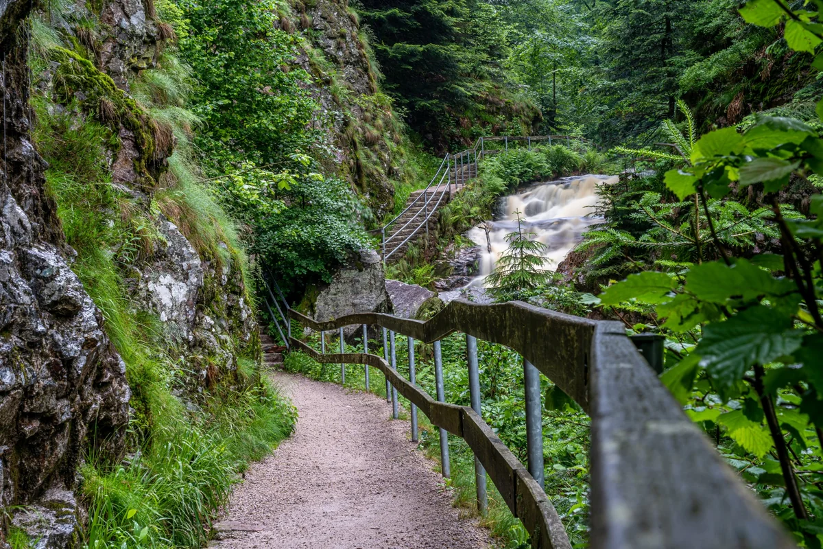
A gravel path with a wooden railing and stone steps beside a rushing waterfall in a green forest gorge
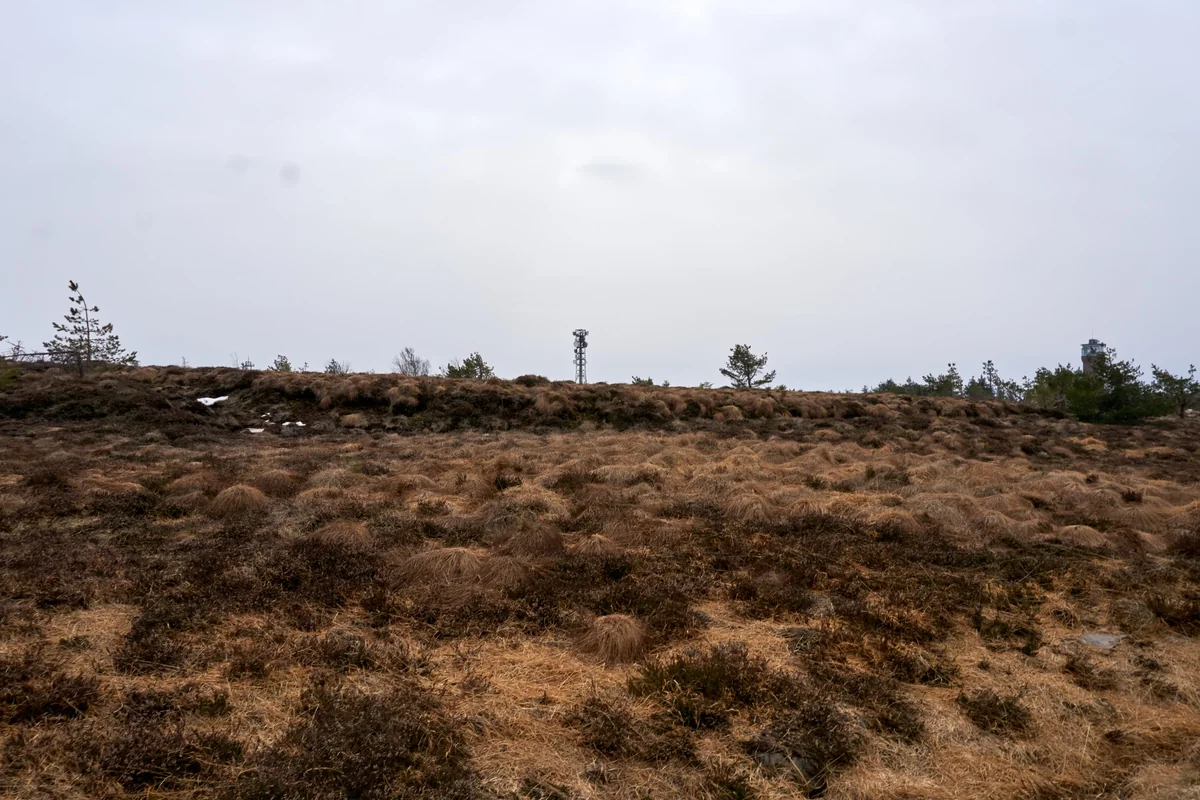
Open moorland with tufts of brown grass and patches of snow on a bare summit plateau, with a transmitter mast and a lookout tower on the skyline
Germany Northern Black Forest (National Park) Verified campsite to campsite, checked November 2026

Black Forest North loop in 6 days

A six-day loop through the Black Forest National Park — moorland summits, legendary lakes and wild forest — with nights at campsites and in tiny trekking camps.

Download GPX
Total distance
80.7 km
Walking days
6
Avg per day
13.5 km
Ascent / descent
+2,590 / −2,590 m
Difficulty
Moderate
Best period
May – Oct
Route type
Loop
Solid line: planned track along OpenStreetMap paths. Dashed: no track yet. Map: OpenFreeMap / OpenStreetMap.

Elevation profile

500 700 900 1100 0 km10 km20 km30 km40 km50 km60 km70 km80 km Day 1 Day 2 Day 3 Day 4 Day 5 Day 6
From 526 m to 1162 m over 80.7 km. Elevation in metres, from the planned track.

When to go

The top row shows when the trail itself is in good condition (snow, heat, services). Below it, when each campsite is open — the trek works when both line up. Trail conditions can differ from year to year, so always keep an eye on local websites before and during your trek.

When the trail is in condition, opening months per campsite, and when all campsites are open together
Row AprMayJunJulAugSepOct
Trail season Not advisedPossibleBestBestBestBestPossible
Campsites open
Seibelseckle (Seebach) ClosedOpenOpenOpenOpenOpenOpen
Allerheiligen (Oppenau) ClosedOpenOpenOpenOpenOpenOpen
Baiersbronn (Ruhesteinstraße) OpenOpenOpenOpenOpenOpenOpen
Baiersbronn-Schönmünzach OpenOpenOpenOpenOpenOpenOpen
Forbach-Erbersbronn OpenOpenOpenOpenOpenOpenOpen
Forbach-Herrenwies OpenOpenOpenOpenOpenOpenOpen
All campsites open ClosedOpenOpenOpenOpenOpenOpen

Day by day

Day 1: Forbach-Herrenwies → Seibelseckle (Seebach)

Distance
14.9 km
Up / down
+490 / −380 m
Walking time
5h

Landscape

Through the forest of the National Park up to the Hornisgrinde (1164 m), the highest summit of the northern Black Forest, across its moorland plateau, then down past the Mummelsee to the Seibelseckle.

Along the way

The open moor and tower on the Hornisgrinde, with views over the Rhine plain to the Vosges; the dark, legendary Mummelsee.

Water & groceries

Restaurant and kiosk at the Mummelsee — fill up there with water for the night (4–5 litres per person).

Tonight

Trekking-Camp Seibelseckle. Trekking camp in the forest — 3 tent pitches, compost toilet, fire pit, no water. Book ahead.

Day 2: Seibelseckle (Seebach) → Allerheiligen (Oppenau)

Distance
13.1 km
Up / down
+360 / −500 m
Walking time
4h 30

Landscape

Along the Westweg over the open heath ridges (Grinden) of the National Park, past the Ruhestein to the Schliffkopf, then down into the forest to the camp.

Along the way

The heathland ridges with wide views; the National Park centre at the Ruhestein; the Allerheiligen waterfalls are a short detour below the camp.

Water & groceries

Cafés at the Ruhestein and the Schliffkopf — carry water for the night from there.

Tonight

Trekking-Camp Erdbeerloch. Trekking camp in the woods near Allerheiligen — 3 tent pitches, no water. Book ahead.

Day 3: Allerheiligen (Oppenau) → Baiersbronn (Ruhesteinstraße)

Distance
16 km
Up / down
+430 / −580 m
Walking time
5h 15

Landscape

Back up to the ridge and through the Lotharpfad, where the forest is left to regrow after the 1999 storm, then a long descent through the woods into the valley above Baiersbronn.

Along the way

The Lotharpfad, with walkways and ladders over fallen trunks and a new wild forest growing between them.

Water & groceries

Little on the way. Shops in Baiersbronn, a few kilometres down the valley from the campsite.

Tonight

Natur-Camp Tannenfels. Small nature campsite with showers — a welcome change after two trekking camps.

Day 4: Baiersbronn (Ruhesteinstraße) → Baiersbronn-Schönmünzach

Distance
12.7 km
Up / down
+370 / −410 m
Walking time
4h 15

Landscape

Over the forested heights north of Baiersbronn and down into the deep Murg valley at Schönmünzach.

Along the way

Quiet forest paths and old farmsteads above the Murg valley.

Water & groceries

Small shops in Schönmünzach; the campsite has a small bar and bread rolls in the morning.

Tonight

Naturcamping Schönmünz. Small nature campsite on a meadow by the Schönmünz stream — book through Alpacacamping.

Day 5: Baiersbronn-Schönmünzach → Forbach-Erbersbronn

Distance
11.5 km
Up / down
+430 / −430 m
Walking time
4h

Landscape

Along the steep, wooded slopes of the Murg valley, with rocky viewpoints over the river, to Erbersbronn.

Along the way

Views down into the narrow Murg valley; rock outcrops along the path.

Water & groceries

Very little — buy food in Schönmünzach. The nearest supermarket to Erbersbronn is in Forbach, about 8 km away.

Tonight

Campingplatz Erbersbronn. Campsite in a side valley below the Schwarzenbach reservoir.

Day 6: Forbach-Erbersbronn → Forbach-Herrenwies

Distance
12.5 km
Up / down
+510 / −290 m
Walking time
4h 15

Landscape

Up past the Schwarzenbach reservoir and over the forested Badener Höhe back to Herrenwies.

Along the way

The Schwarzenbach lake behind its dam; the Friedrichsturm lookout tower on the Badener Höhe, just off the route.

Water & groceries

Restaurant at the Schwarzenbach dam (seasonal). Very little in Herrenwies.

Tonight

Naturcamping Herrenwies. Back at the start campsite in Herrenwies (open April – October).

Walking times are calculated with the DIN 33466 hiking formula (4 km/h, 300 m/h up, 500 m/h down), without breaks.

About this trek

The northern Black Forest is the wildest part of the range. Around the Hornisgrinde and the Ruhestein, the Black Forest National Park lets the forest grow back without intervention, and the ridges are covered in open heath and moorland rather than trees.

This loop links the best of it in six short days. It sleeps twice in a trekking camp — a small clearing in the forest with three tent platforms — and four times at regular campsites in the valleys.

About the trekking camps. The Black Forest trekking camps are the only legal way to sleep in the forest itself. Each has just three tent pitches (max. three people per pitch), a compost toilet and a fire pit, but no water. They must be booked online at trekking-schwarzwald.de (15 € per tent per night, 1 May – 31 October), and they fill up fast at weekends — book these two nights first and plan the rest around them.

Campsite to Campsite check

Automatic check of our eight conditions.

  • Every night at a regular campsite that accepts tents
  • Every campsite reachable on foot from the route
  • Each stage starts where yesterday ended — at most a short transfer of 30 minutes, always shown
  • No wild camping or bivouacs needed
  • No huts, hotels or hostels as standard overnight
  • All campsites open during the stated season
  • Daily distance and ascent measured and checked
  • Walkable with a full trekking pack

GPX downloads

Works with Garmin, Komoot, OsmAnd and other apps.

Walked it recently?

Report a closed campsite, a detour or a new water point. Every report is checked before the route changes.

Report an update

Black Forest North loop in 6 days