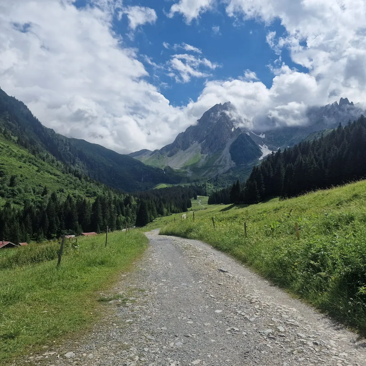
Gravel track through green alpine pastures towards a rocky peak in the clouds
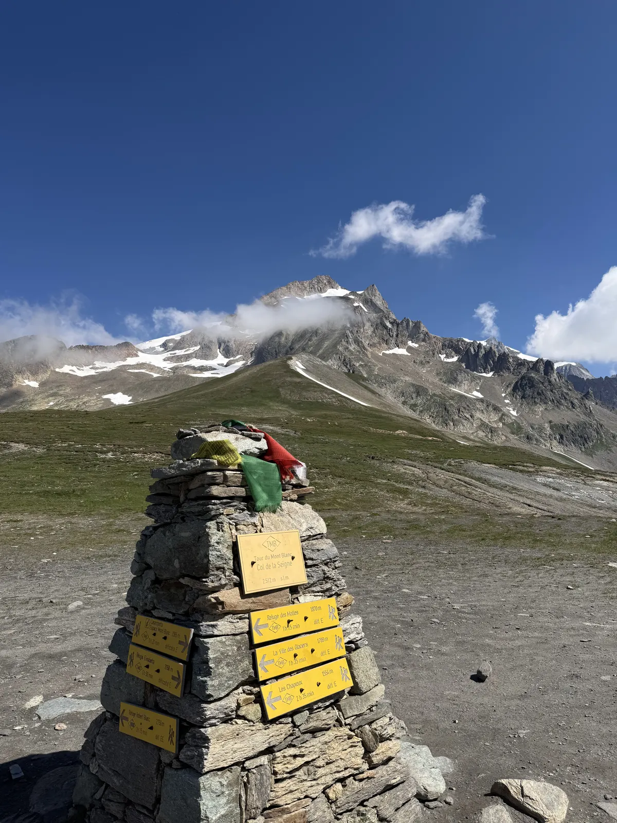
Stone cairn with yellow signposts and prayer flags on the Col de la Seigne
FranceItalySwitzerland Mont Blanc Verified campsite to campsite, checked November 2026

Tour du Mont Blanc in 9 days

The classic loop around Mont Blanc through France, Italy and Switzerland — high passes, glaciers and balcony paths, with a campsite every night and your own tent on your back.

Download GPX
Total distance
172.4 km
Walking days
9
Avg per day
19.2 km
Ascent / descent
+10,840 / −10,840 m
Difficulty
Challenging
Best period
Jun – Sep
Route type
Loop
Solid line: planned track along OpenStreetMap paths. Dashed: no track yet. Map: OpenFreeMap / OpenStreetMap.

Elevation profile

900 1300 1700 2100 2500 0 km10 km20 km30 km40 km50 km60 km70 km80 km90 km100 km110 km120 km130 km140 km150 km160 km170 km Day 1 Day 2 Day 3 Day 4 Day 5 Day 6 Day 7 Day 8 Day 9
From 976 m to 2667 m over 172.4 km. Elevation in metres, from the planned track.

Photos from the trail

1 / 6
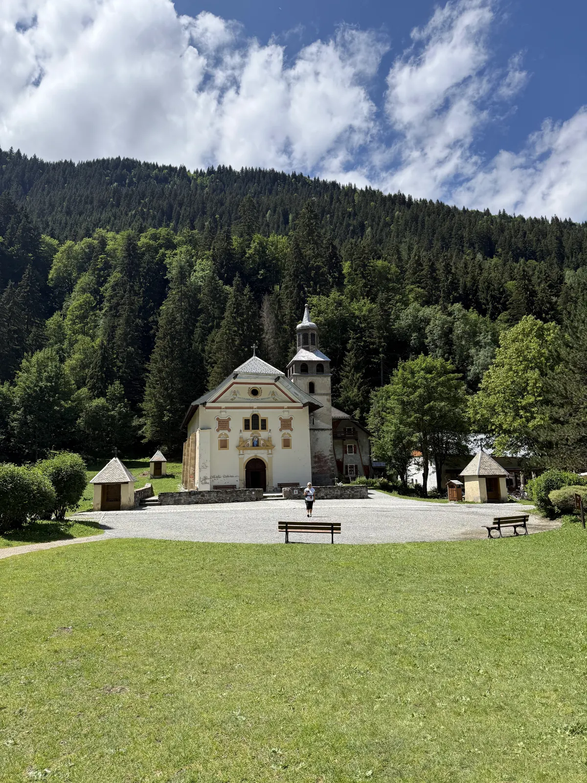
The baroque chapel of Notre-Dame de la Gorge in a clearing in the forest
Notre-Dame de la Gorge, at the foot of the climb to the Col du Bonhomme (day 2)
Gravel track through green alpine pastures towards a rocky peak in the clouds
Wide tracks and alpine pastures on the French side
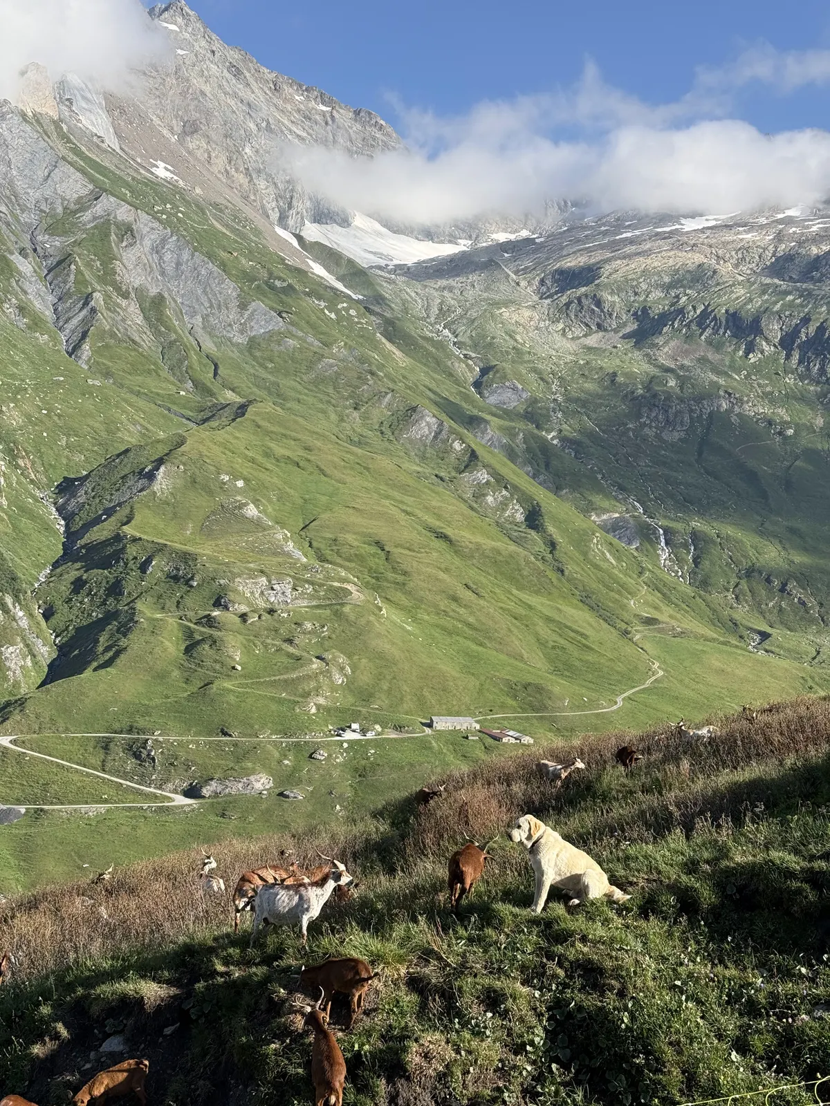
Goats and a white guard dog on a grassy slope above a valley with a winding track
Goats and their guard dog on the climb up the Vallée des Glaciers (day 3)
Stone cairn with yellow signposts and prayer flags on the Col de la Seigne
The border cairn on the Col de la Seigne, 2516 m — France behind, Italy ahead (day 3)
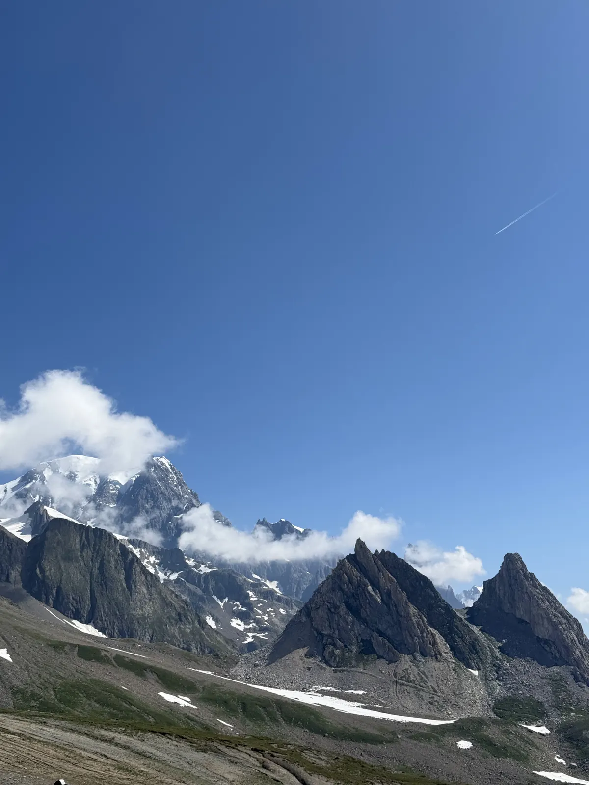
Jagged granite peaks and glaciers of the Mont Blanc massif under a blue sky
The first view of the Italian side of the Mont Blanc massif (day 3)
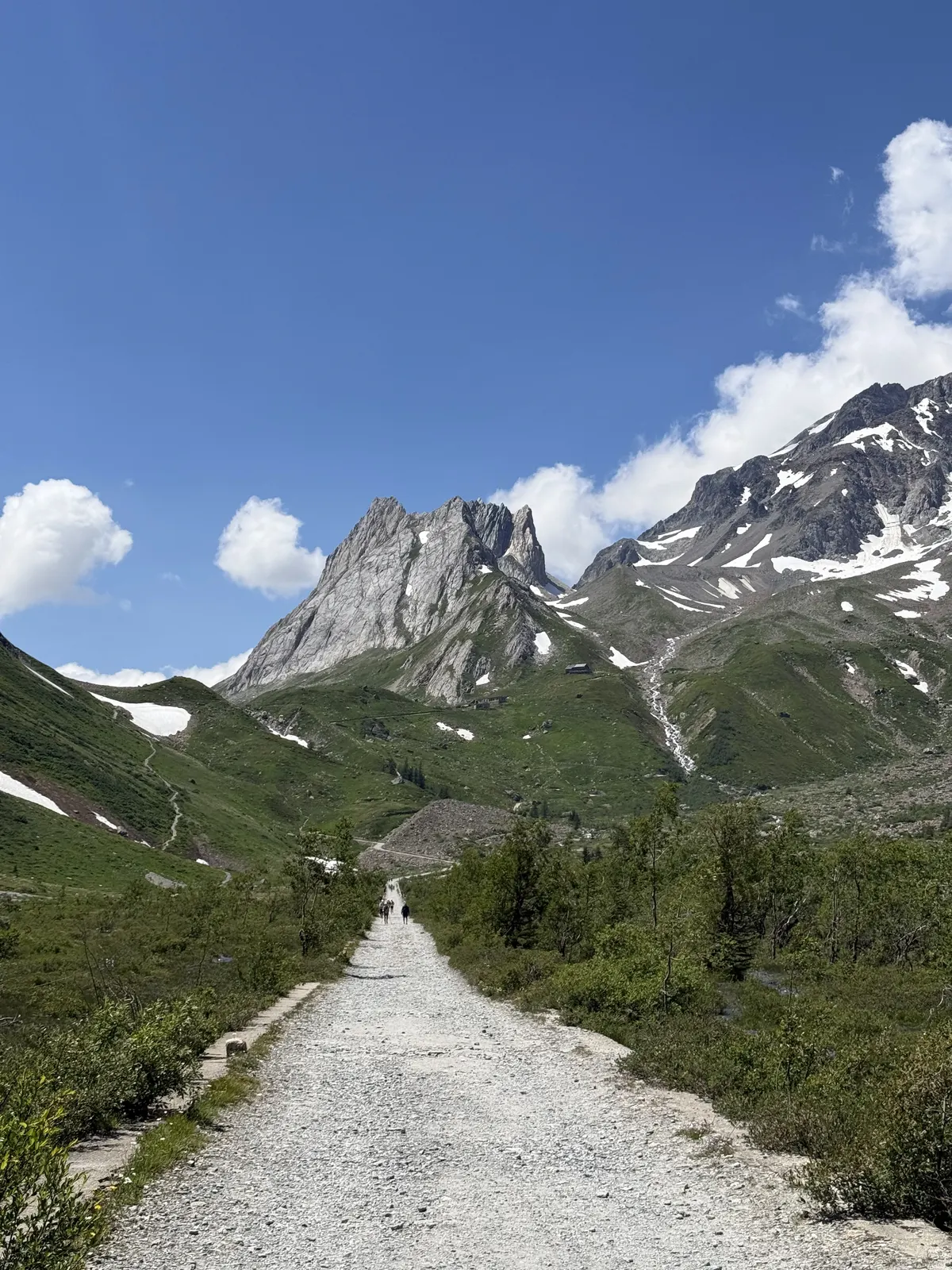
Wide gravel path descending a green valley towards limestone towers and snowy peaks
Down the Lex Blanche valley towards Val Veny (day 3)

When to go

The top row shows when the trail itself is in good condition (snow, heat, services). Below it, when each campsite is open — the trek works when both line up. Trail conditions can differ from year to year, so always keep an eye on local websites before and during your trek.

When the trail is in condition, opening months per campsite, and when all campsites are open together
Row AprMayJunJulAugSepOct
Trail season Not advisedNot advisedPossibleBestBestBestNot advised
Campsites open
Les Contamines-Montjoie OpenOpenOpenOpenOpenOpenPart
Les Chapieux ???????
Val Veny (Courmayeur) ClosedClosedOpenOpenOpenOpenClosed
Planpincieux, Val Ferret (Courmayeur) ClosedClosedPartOpenOpenPartClosed
La Fouly ClosedPartOpenOpenOpenOpenPart
Champex-Lac ClosedClosedOpenOpenOpenOpenOpen
Col de la Forclaz (Trient) ClosedClosedPartOpenOpenOpenClosed
Argentière (Chamonix) ClosedPartOpenOpenOpenOpenClosed
Les Houches ClosedPartOpenOpenOpenOpenClosed
All campsites open ClosedClosedPartOpenOpenPartClosed

Sources: 10adventures.com

Day by day

Day 1: Les Houches → Les Contamines-Montjoie

Distance
18.9 km
Up / down
+1,070 / −870 m
Walking time
7h 45

Landscape

Up through forest and meadows to the Col de Voza (1653 m), with the Bionnassay glacier ahead, then down through the hamlets of Bionnassay and Le Champel to Les Contamines.

Along the way

Close-up views of the Aiguille de Bionnassay; the Mont-Blanc tramway at the Col de Voza.

Water & groceries

Shops in Les Houches. Seasonal cafés at the Col de Voza and Bionnassay. Shops in Les Contamines, about 2 km before the campsite.

Tonight

Camping du Pontet. Campsite by a small lake at the top end of Les Contamines.

Day 2: Les Contamines-Montjoie → Les Chapieux

Distance
16.8 km
Up / down
+1,310 / −940 m
Walking time
8h 15

Landscape

Past the baroque chapel of Notre-Dame de la Gorge and up the old Roman road, through alpine pastures to the Col du Bonhomme and the Col de la Croix du Bonhomme (2479 m), then a long descent to Les Chapieux.

Along the way

The Roman road above Notre-Dame de la Gorge; the wide views from the Croix du Bonhomme into the Beaufortain.

Water & groceries

Water and meals at the Refuge de Nant Borrant, Refuge de la Balme and Refuge du Col de la Croix du Bonhomme. Small shop and auberge in Les Chapieux.

Tonight

Aire de bivouac des Chapieux. Communal camping area with water and toilets — the official place to pitch a tent in Les Chapieux.

Day 3: Les Chapieux → Val Veny (Courmayeur)

Distance
22.2 km
Up / down
+1,030 / −1,060 m
Walking time
8h 15

Landscape

A long day. Up the Vallée des Glaciers to the Refuge des Mottets, a steady climb to the Col de la Seigne (2516 m) on the French–Italian border, then down past the Rifugio Elisabetta and the Lac Combal into Val Veny.

Along the way

The first view of the Italian side of Mont Blanc from the Col de la Seigne; the moraine of the Miage glacier and the Lac Combal.

Water & groceries

Water and meals at the Refuge des Mottets, Rifugio Elisabetta and the Cabane du Combal. No shops until Courmayeur.

Tonight

Campeggio Aiguille Noire. Campsite in the larch forest of Val Veny. Too long? Take the summer shuttle bus from Les Chapieux to La Ville des Glaciers (saves about 5 km of road), or split the day with a night at the Refuge des Mottets or Rifugio Elisabetta.

Day 4: Val Veny (Courmayeur) → Planpincieux, Val Ferret (Courmayeur)

Distance
16.9 km
Up / down
+1,310 / −1,230 m
Walking time
9h

Landscape

A climb out of Val Veny to the Col Chécrouit, down into Courmayeur, then up again to the Rifugio Bertone and down into the Italian Val Ferret.

Along the way

The south face of Mont Blanc and the Brenva glacier from Chécrouit; the terrace of the Rifugio Bertone facing the Grandes Jorasses.

Water & groceries

Full supplies in Courmayeur — stock up for the next two days. Rifugio Bertone for drinks and meals.

Tonight

Camping Grandes Jorasses. Campsite at Planpincieux, right below the Grandes Jorasses.

Day 5: Planpincieux, Val Ferret (Courmayeur) → La Fouly

Distance
28 km
Up / down
+1,570 / −1,570 m
Walking time
11h 45

Landscape

A long day with two big climbs. Up from Planpincieux onto the balcony path high above Val Ferret, along to the Rifugio Bonatti and down to Arnouvaz, then up past the Rifugio Elena to the Grand Col Ferret (2537 m) on the Swiss border and a long, gentle descent through pastures to La Fouly.

Along the way

The whole Mont Blanc massif face to face from the balcony, from Mont Blanc to the Grandes Jorasses; the Pré de Bar glacier from the Rifugio Elena; the view back over Italy from the Grand Col Ferret.

Water & groceries

No water on the balcony — carry enough. Drinks and meals at the Rifugio Bonatti, Arnouvaz and the Rifugio Elena; cheese at the Alpage de la Peule (seasonal). Small shop in La Fouly.

Tonight

Camping des Glaciers. Large campsite below the glaciers of the Mont Dolent and Tour Noir. The longest day of the tour (28 km). Too long? Sleep at the Rifugio Bonatti or the Rifugio Elena, or take the summer bus from Planpincieux to Arnouvaz (saves the balcony, about 10 km).

Day 6: La Fouly → Champex-Lac

Distance
14.9 km
Up / down
+520 / −630 m
Walking time
5h 15

Landscape

Down the Swiss Val Ferret through forest and old villages, then up through the woods to the lake at Champex.

Along the way

The wooden chalets and granaries of Praz-de-Fort and Issert; Champex-Lac.

Water & groceries

Fountains in the villages. Shops and bakery in Champex-Lac.

Tonight

Camping Les Rocailles. Campsite in the lakeside resort of Champex-Lac.

Day 7: Champex-Lac → Col de la Forclaz (Trient)

Distance
13.2 km
Up / down
+1,210 / −1,160 m
Walking time
8h

Landscape

Up the wild Val d'Arpette and over the Fenêtre d'Arpette (2665 m) — a steep, rocky pass, the highest point of the tour — then down along the Trient glacier to the Col de la Forclaz. In bad weather or snow, take the lower route via Alp Bovine instead.

Along the way

The view straight down onto the Trient glacier; the boulder fields below the Fenêtre.

Water & groceries

Relais d'Arpette at the start; seasonal buvette near the Trient glacier. Small shop and restaurant at the Hôtel du Col de la Forclaz.

Tonight

Camping de l'Arpille. Small campsite run by the hotel on the pass.

Day 8: Col de la Forclaz (Trient) → Argentière (Chamonix)

Distance
15.8 km
Up / down
+1,010 / −1,310 m
Walking time
8h

Landscape

Down to the village of Trient, up through forest and pastures to the Col de Balme (2191 m) on the Swiss–French border, then down towards Le Tour and Argentière.

Along the way

The pink church of Trient; the Col de Balme, with the whole Chamonix valley and Mont Blanc ahead.

Water & groceries

Water in Trient and at the Refuge du Col de Balme. Supermarket and shops in Argentière.

Tonight

Camping du Glacier d'Argentière. Campsite just outside Argentière, facing the Argentière glacier.

Day 9: Argentière (Chamonix) → Les Houches

Distance
25.7 km
Up / down
+1,810 / −2,070 m
Walking time
13h 30

Landscape

The grand finale, and the hardest day. A steep climb from Argentière onto the Grand Balcon Sud, then the whole balcony — La Flégère, Planpraz and the Col du Brévent — with Mont Blanc across the valley all day, and finally the long, steep descent past the Refuge de Bellachat to Les Houches.

Along the way

The detour to Lac Blanc (2352 m), with Mont Blanc reflected in the water — about 2 km and 250 m extra from the junction above La Flégère; ibex in the Aiguilles Rouges; Mont Blanc and the Bossons glacier straight across from Bellachat.

Water & groceries

Refuge du Lac Blanc, La Flégère, Planpraz and the Refuge de Bellachat for drinks and meals. Shops in Les Houches. No camping in the Aiguilles Rouges nature reserve.

Tonight

Camping Bellevue. Back at the start campsite in Les Houches. Too long? Split it with the cable car down from La Flégère or Planpraz to Chamonix and a night at a Chamonix campsite, or sleep at the Refuge de la Flégère or the Refuge de Bellachat.

Walking times are calculated with the DIN 33466 hiking formula (4 km/h, 300 m/h up, 500 m/h down), without breaks.

About this trek

The Tour du Mont Blanc is one of the great walks of Europe: a loop of about 170 km around the highest mountain in Western Europe, through France, Italy and Switzerland. Every day crosses a high pass or follows a balcony path, with glaciers, alpine lakes and the Mont Blanc massif always in view.

Most people walk the TMB from hut to hut, but it works very well with a tent. There are campsites in almost every valley, and this route uses them every night — except at Les Chapieux, where the official communal camping area is the only place to pitch a tent. Three stages are much longer than the rest — Les Chapieux – Val Veny (22.2 km), the Italian balcony to La Fouly (28 km) and the Grand Balcon Sud back to Les Houches (25.7 km). Each can be shortened with a bus or cable car, or split with a night in a hut.

When to go. The high passes are usually free of snow from late June or early July to mid-September, and most campsites and huts are only open in that period. July and August are busy — book the Italian campsites ahead if you can.

Before you go. Book the Italian campsites ahead for July and August: Campeggio Aiguille Noire in Val Veny and Camping Grandes Jorasses in Val Ferret fill up fast. Check the summer bus timetables shortly before you leave, because they change every year: the shuttle from Les Chapieux to La Ville des Glaciers, and the buses in Val Ferret and Val Veny that you can use to shorten days 3, 4 and 5.

Why campsite to campsite here? Wild camping is restricted on almost the whole TMB: forbidden in Switzerland outside designated places, banned below 2500 m in the Aosta Valley, and tightly controlled in France. Valley campsites are the legal, comfortable and affordable way to walk the tour with your own tent.
Campsite to Campsite check

Automatic check of our eight conditions.

  • Every night at a regular campsite that accepts tents
  • Every campsite reachable on foot from the route
  • Each stage starts where yesterday ended — at most a short transfer of 30 minutes, always shown
  • No wild camping or bivouacs needed
  • No huts, hotels or hostels as standard overnight
  • All campsites open during the stated season
  • Daily distance and ascent measured and checked
  • Walkable with a full trekking pack

Walked it recently?

Report a closed campsite, a detour or a new water point. Every report is checked before the route changes.

Report an update

Tour du Mont Blanc in 9 days