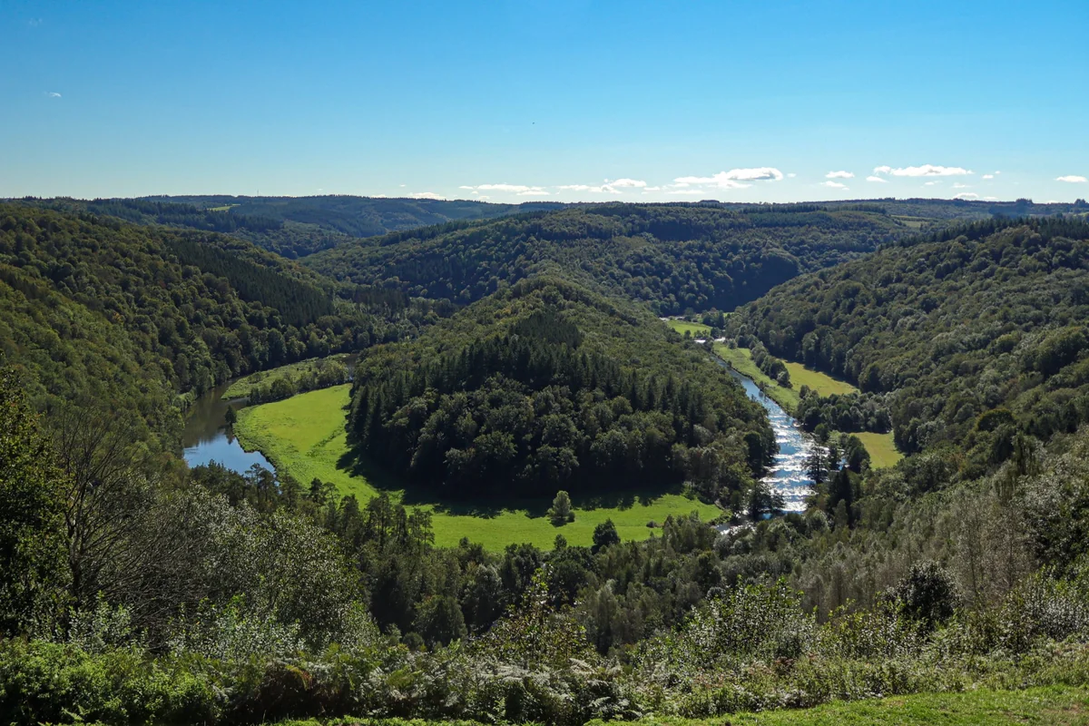
The Tombeau du Géant, a wooded hill wrapped in a wide loop of the Semois near Botassart, seen from the viewpoint above
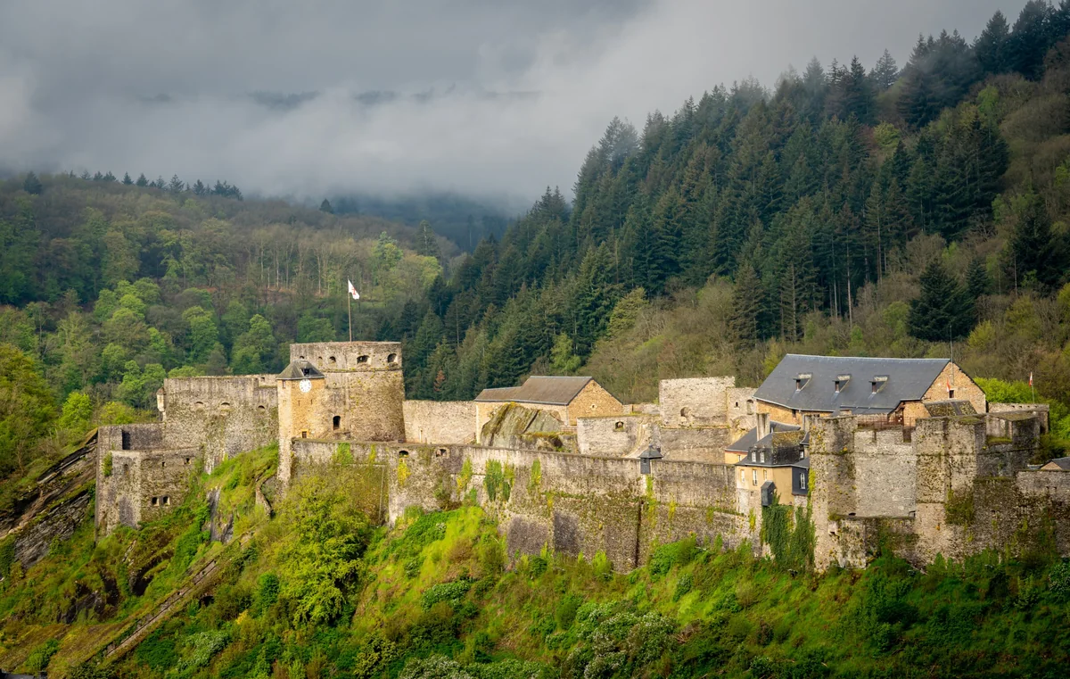
The medieval castle of Bouillon on its rocky ridge, with forested hills and low cloud behind
Belgium Semois Verified campsite to campsite, checked November 2026

Semois Valley in 6 days

Six easy days along the meandering Semois in the Belgian Ardennes — forested ridges, slate villages and famous viewpoints, with a riverside campsite every few kilometres.

Download GPX
Total distance
74.4 km
Walking days
6
Avg per day
12.4 km
Ascent / descent
+2,540 / −2,650 m
Difficulty
Moderate
Best period
Apr – Sep
Route type
Point to point
Solid line: planned track along OpenStreetMap paths. Dashed: no track yet. Map: OpenFreeMap / OpenStreetMap.

Elevation profile

100 200 300 400 500 0 km10 km20 km30 km40 km50 km60 km70 km Day 1 Day 2 Day 3 Day 4 Day 5 Day 6
From 169 m to 424 m over 74.4 km. Elevation in metres, from the planned track.

When to go

The top row shows when the trail itself is in good condition (snow, heat, services). Below it, when each campsite is open — the trek works when both line up. Trail conditions can differ from year to year, so always keep an eye on local websites before and during your trek.

When the trail is in condition, opening months per campsite, and when all campsites are open together
Row AprMayJunJulAugSepOct
Trail season Not advisedBestBestPossiblePossibleBestNot advised
Campsites open
Herbeumont OpenOpenOpenOpenOpenOpenOpen
Dohan OpenOpenOpenOpenOpenPartClosed
Bouillon PartOpenOpenOpenOpenOpenOpen
Poupehan ???????
Mouzaive PartOpenOpenOpenOpenOpenPart
Bohan OpenOpenOpenOpenOpenOpenClosed
All campsites open PartOpenOpenOpenOpenPartClosed

Day by day

Day 1: Florenville → Herbeumont

Distance
16.4 km
Up / down
+320 / −320 m
Walking time
5h

Landscape

Through the Gaume along the upper Semois, mostly on forest paths and tracks above the river.

Along the way

The Dolmen d'Azy and a viewpoint over the valley; the Semois winding below wooded slopes.

Water & groceries

Supermarkets in Florenville. Little on the way — carry lunch.

Tonight

Retro-camping Champ le Monde. Campsite in the valley below Herbeumont.

Day 2: Herbeumont → Dohan

Distance
12.1 km
Up / down
+480 / −530 m
Walking time
4h 15

Landscape

Over forested ridges and down to the river in tight meanders, almost entirely on forest paths.

Along the way

Herbeumont castle ruins with views over the valley; the meanders at Mortehan and Cugnon.

Water & groceries

Small shops in Herbeumont. Very little in Dohan.

Tonight

Camping Maka. Riverside campsite on a bend of the Semois.

Day 3: Dohan → Bouillon

Distance
13.6 km
Up / down
+580 / −470 m
Walking time
4h 45

Landscape

Long forest stretches on the ridges between the river loops.

Along the way

The Mont de Zatrou viewpoint; arrival in Bouillon below its medieval castle.

Water & groceries

Full shops and restaurants in Bouillon.

Tonight

Camping Papillon. Campsite on the plateau about 2 km above Bouillon (included in today's distance) — do your shopping in town first.

Day 4: Bouillon → Poupehan

Distance
14.2 km
Up / down
+470 / −620 m
Walking time
5h

Landscape

Up out of Bouillon onto the ridges and down to one of the Semois' most famous loops.

Along the way

Bouillon castle, the Belvédère d'Auclin, the Tombeau du Géant meander, La Roche Gilquin and the Rocher de l'Hermitage.

Water & groceries

Stock up in Bouillon. Very limited in Poupehan.

Tonight

Camping d'Houlifontaine. Two-star campsite on the river at Poupehan.

Day 5: Poupehan → Mouzaive

Distance
9 km
Up / down
+370 / −360 m
Walking time
3h 15

Landscape

Across the Semois at Poupehan, then on the GR 16 over the wooded ridge to Frahan and down along the river to Mouzaive.

Along the way

The Panorama de Frahan over the hamlet in its meander.

Water & groceries

Café in Frahan; shops in Alle-sur-Semois, a short detour.

Tonight

Camping Huttopia Vallée de la Semois. Huttopia campsite on the river at Mouzaive — busy with families in summer.

Day 6: Mouzaive → Bohan

Distance
9.1 km
Up / down
+320 / −350 m
Walking time
3h 15

Landscape

On the GR 16 along the river to Vresse, then over the wooded hills to Membre and Bohan.

Along the way

Vresse-sur-Semois and its old bridge; Membre and Bohan near the French border.

Water & groceries

Cafés in Vresse; small supermarket and restaurants in Bohan.

Tonight

Camping La Douane. Family campsite on the river at the edge of Bohan, with a canteen.

Walking times are calculated with the DIN 33466 hiking formula (4 km/h, 300 m/h up, 500 m/h down), without breaks.

About this trek

The Semois is the most winding river of the Belgian Ardennes. On its way to France it loops back on itself again and again, cutting deep valleys through forested hills. Between the loops sit slate-roofed villages, old tobacco barns and some of the best viewpoints in Belgium.

This route follows the river for six days from Florenville to Bohan. The stages are short, so there is time for a swim, a terrace or a detour to a viewpoint. Expect regular short, steep climbs between the river and the ridges.

Why campsite to campsite here? Few valleys in Europe have so many campsites so close together — in places every few kilometres. That makes the route easy to shorten, lengthen or split in two (Florenville – Bouillon and Bouillon – Bohan).

Campsite to Campsite check

Automatic check of our eight conditions.

  • Every night at a regular campsite that accepts tents
  • Every campsite reachable on foot from the route
  • Each stage starts where yesterday ended — at most a short transfer of 30 minutes, always shown
  • No wild camping or bivouacs needed
  • No huts, hotels or hostels as standard overnight
  • All campsites open during the stated season
  • Daily distance and ascent measured and checked
  • Walkable with a full trekking pack

GPX downloads

Works with Garmin, Komoot, OsmAnd and other apps.

Walked it recently?

Report a closed campsite, a detour or a new water point. Every report is checked before the route changes.

Report an update

Semois Valley in 6 days